
Just off the southwestern coast of the United Kingdom, the Isles of Scilly form a jagged, treacherous archipelago that has claimed hundreds of ships. The most infamous of these disasters unfolded on a stormy October night in 1707, when a British naval fleet crashed headlong into the reefs, destroying four ships and killing roughly two thousand sailors.
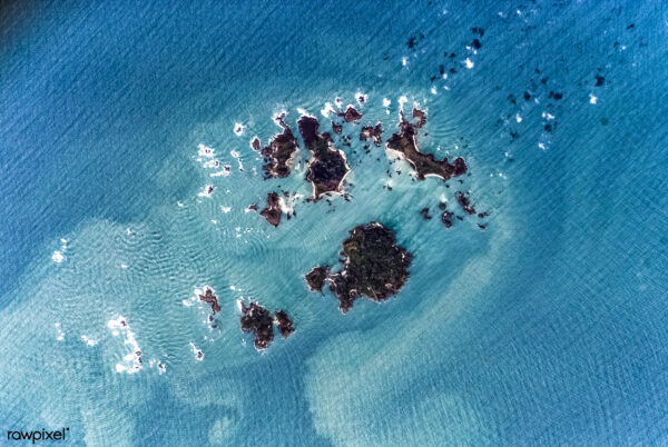
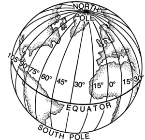
The fleet wasn’t undone by incompetence but by bad weather and– crucially– the fact that they were missing piece of mathematical infrastructure: their longitude. While sailors could easily determine their latitude by measuring the angle of the sun or the North Star, calculating their east-west position on a continuously spinning globe remained one of the era’s most stubborn scientific hurdles. Without it, navigators were forced to rely on dangerous guesswork like dead reckoning, leaving them vulnerable to getting lost, running aground, or being ambushed by pirates along predictable routes.
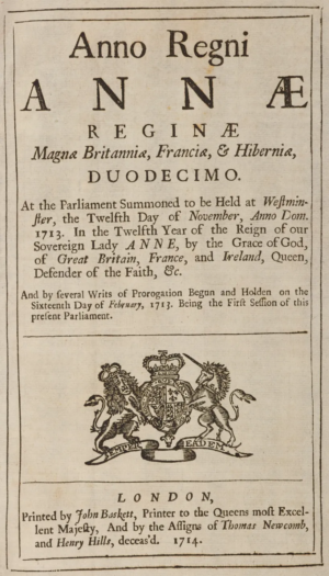 Desperate to secure safer, faster sea routes for an expanding empire, the British Parliament passed the Longitude Act in 1714, offering a massive £20,000 prize to anyone who could solve the problem. While the scientific establishment assumed the answer would naturally come from astronomy, the breakthrough was ultimately engineered by a self-taught clockmaker named John Harrison. The theoretical math was already understood; since the Earth rotates fifteen degrees every hour, calculating the time difference between a ship’s current location and a fixed reference point would yield its exact distance. The actual barrier was material science. Pendulum clocks failed completely in rolling seas, while temperature fluctuations warped metal components and salty air corroded delicate gears.
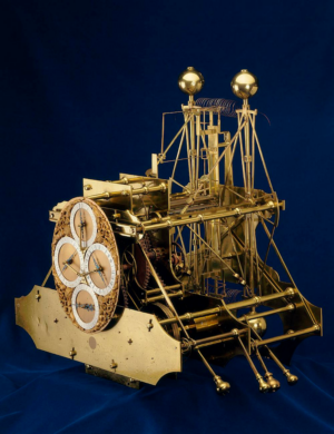
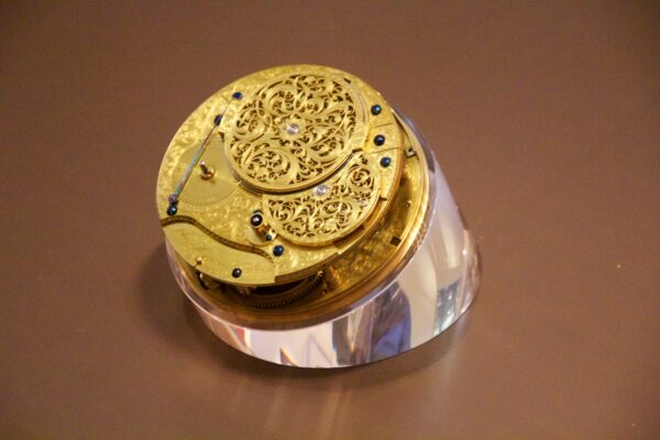
Harrison approached these environmental constraints with sheer mechanical ingenuity. To survive the harsh maritime conditions, he devised interconnected bar balances to counteract the motion of the ocean, utilized bimetallic strips to compensate for extreme temperature shifts, and even milled gears a naturally self-lubricating wood that eliminated the need for messy clock oil. After his massive, gleaming brass prototype performed remarkably well on a test voyage to Lisbon, Harrison fell victim to his own perfectionism. He spent decades agonizing over minute improvements, eventually abandoning his large clock designs entirely after realizing the answer lay in extreme miniaturization. His ultimate masterpiece, H4, was an ornate, watch-sized timekeeper weighing just three pounds that proved accurate to within a single nautical mile on a transatlantic voyage.
Despite this technological triumph, the pragmatic Board of Longitude continually moved the goalposts, doubting that Harrison’s singular genius could be reliably mass-produced. It took a direct appeal to King George III for the aging inventor to finally receive the financial reward he was owed, though he was never officially awarded the Longitude Prize itself. Eventually, manufacturers learned to replicate his underlying design, creating the standardized marine chronometer. This incredibly precise instrument revolutionized global navigation, allowing mapmakers to confidently chart the globe while simultaneously serving as a crucial tool for the rapid, often brutal expansion of the British Empire and permanently cementing Greenwich as the Prime Meridian.
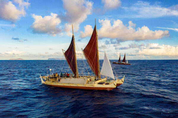
Yet centuries before European powers cracked the mechanical secret of longitude, navigators in the Pacific were already traversing thousands of miles of open ocean between tiny island targets. Rather than attempting to impose an imaginary geometric grid onto the water or relying on fragile brass instruments, traditional Polynesian wayfinding utilizes a holistic understanding of the natural world Navigators treat the ocean as an expansive, interconnected compass reading wave refraction patterns, cloud formations, star paths, and the flight behaviors of land birds to determine their exact position. In this highly tuned system, an island is not merely a geographic pinpoint to be plotted, but a massive, radiating ecosystem offering a completely different but equally elegant solution to the ancient challenge of finding one’s way safely across the sea.
If you enjoyed learning about Lehua Kamalu’s work on Polyesian voyaging canoes and want to track the Moananuiākea Voyage, you can do so here.

Comments (1)
Share
“the Pandora building in beautiful uptown Oakland, California–that’s around 37.810 North, 122.267 South. ”
South?!! Try West. I guess latitude IS hard. It made it into the podcast, it’s in the transcript and nobody caught that it is not only wrong, but makes no sense.